Project description
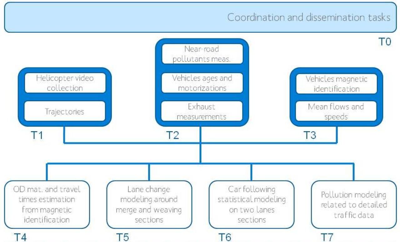
The project is summarized in the figure above. So far, the main realizations of the project are twofold:
- Task 1 has permitted to collect, with a helicopter located 500 m above the highway, a great amount of videos (more than seven hours of traffic evolution will be available). The transformation from video data towards individual trajectories is made with the help of a software developed at TU Delft and samples will soon be made available. The films were taken on a simple but highly congested highway, at three locations:
- A merge
- A standard section without on or off-ramps,
- A weaving section with two entrances and three exits.
- Task 2 has collected simultaneously detailed traffic and pollution data to better understand how the vehicles emissions can be related to traffic conditions, in particular in congested regime.
Another data collection task has collected, through magnetometers, individual signatures of vehicles and analysis of the individual identification permitted to produce OD matrices.
Beginning later in the project plan, a set of four modeling tasks will permit to take benefits of the data collected to answer some of the most actual questions about traffic and pollution estimation:
- Task 4 will be devoted to use individual identification to build dynamic local OD matrices and mean travel times estimations;
- Task 5 will focus on the lane changing process in merging and weaving zones;
- Task 6 will analyze the car following behavior and in particular the distance preservation behavior of drivers inside platoon on no-entry no-exit zones;
- Eventually, Task 7 will use the classification of all the vehicles circulating on the highway (by age and fuel used) and the relatively detailed traffic data to estimate with a small time scale the flow emission and subsequently estimate the atmospheric dispersion of the pollutants. A comparison will then be conducted with the near-road pollution measurements realized in Task 2.

